
Satellite Communicator
While my car was being serviced I was sitting in the auto dealer’s waiting room. I was bored. I looked at the dense clouds outside and decided to see if my satellite communicator could pick up the satellites through that cloud layer.
I walked outside the building and stood on a grassy area between two parking lots. I turned my satellite communicator on, pushed the message button and sent an automated message to all of the members of my family.
Lights started flashing to tell me the communicator was looking for satellites. In a minute or two it found the satellites and a light flashed to tell me the message had been sent. At the same time my phone beeped to tell me a message had been received. In addition to going to my family, any messages I send are also sent to me.
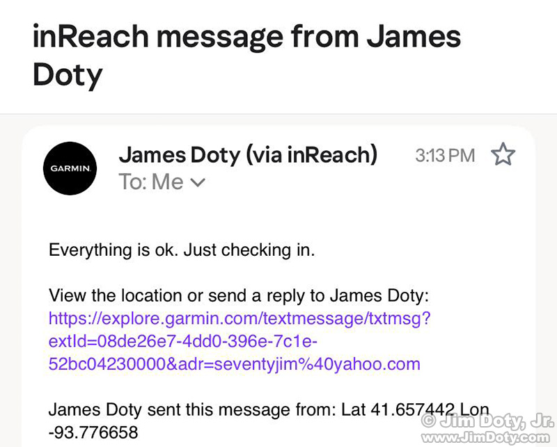
The message that was sent from my satellite communicator.
This is the text message my family received: “Everything is ok. Just checking in.” Also included is a link to a map at Garmin to show my family my location. The message also includes the GPS coordinates of the location I was at when I sent the message. They are in a digital form. More about that later.
I clicked on the link to the map of my location.
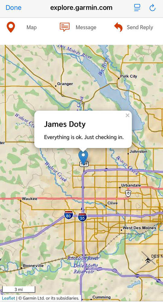
Map of my location with an overlay of my message.
As you can see, I am in the Des Moines area.
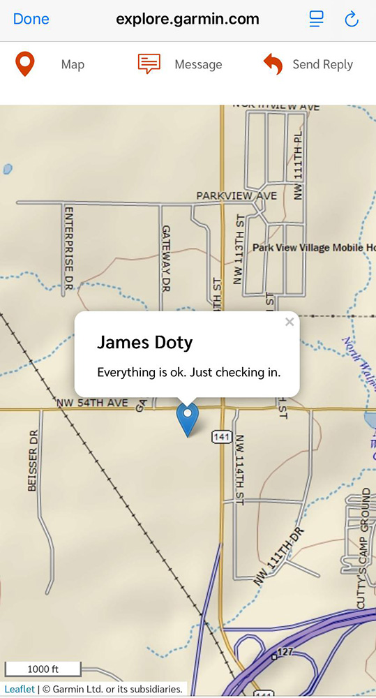
I zoomed in on the map. I am west of IA-141 and south of NW 54th Ave.
When I sent the message, the communicator automatically included the digital GPS coordinates:
Lat 41.657442
Lon -93.776658
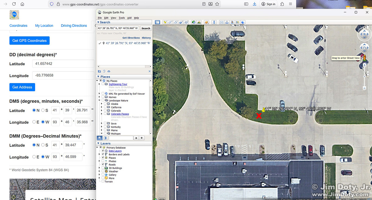
GPS coordinates converter (left) and Google Earth Pro.
I went to an online site that converts GPS coordinates. You can see it on the left. I entered the digital coordinates and it converted them to degrees, minutes, and seconds. Next I opened Google Earth Pro and in the search box at the upper left I entered the coordinates. Google Earth Pro opened a satellite map and dropped a yellow pin at the location of the GPS coordinates. I did a screen capture of Google Earth Pro and added a Red X at the approximate location where I was standing. I was half way in between the two concrete parking lots. The yellow pin is roughly 10-15 feet from the Red X. That is pretty good. Consumer grade satellites are usually accurate to within 30 feet of your actual location.
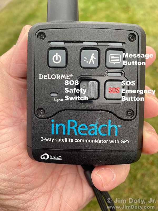
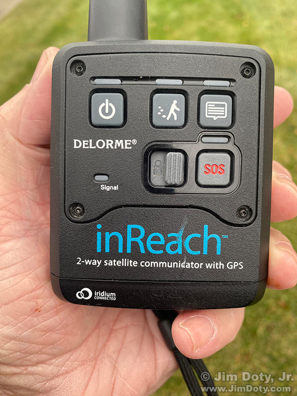
Satellite Communicator with labels.
The message button is at the upper right. By pushing this button I can send pre-determined messages to my family, like “Just checking in”, or “I will be late”, or “This is not an SOS emergency but I need help”. This older model communicator does not have a keyboard to type messages, but it can be paired with a smart phone to send custom messages. You type the message on your smart phone and the communicator sends the message via satellite. Current communicator models have a keyboard like the one on your phone.
In a life threatening emergency, one push of the SOS Emergency Button will send a rescue team to my location. To avoid an accidental SOS message being sent, there is a sliding safety switch. You slide the switch before pushing the SOS button.
If I was on some isolated high mountain road, I had no cell signal, the car died and would not restart, I would need help, but it is not a life threatening emergency. I would not push the SOS button. I would push the message button and send the “This is not an SOS emergency but I need help”. My family would check the GPS coordinates to determine my location, call the county sheriff, tell them it was not a life threatening emergency but I needed help, and give them my GPS coordinates.
Every year lives are saved by satellite communicators. They do not depend on cell phone signals so you can call for help from anywhere as long as the communicator can “see” the satellites. They don’t work if you are in a cave, or under an overhanging cliff. You need to get out in the open so the communicator can see the satellites that are scattered across the sky.
A friend of mine was climbing up high on a mountain and he ended up stranded on a narrow mountain ledge, unable to move. His life was in danger. He had barely enough room to stand. As it began to rain and the ledge got slick he was in danger of slipping off the ledge and falling to his death. He had no cell phone signal. His satellite communicator allowed him to send an SOS call for help, communicate with a mountain rescue team, and also to communicate with his family. I got a message from his wife asking me to pray for him. A rescue team and helicopter showed up. His satellite communicator saved his life.
Every year there are people who end up stranded, alone, in trouble, and die because they had no cell phone signal and no way to call for help. A $300 satellite communicator would have allowed them to call for help.
There are times I am alone in some mountain wilderness taking pictures. If I slip and fall, or get injured in some way and can’t move, and my life is in danger, it is comforting to me and my family that I have a satellite communicator. It lives in the car. If I leave the car and head into the wilderness, I put it in my backpack.
In non-emergency situations when I will be out of cell phone range for hours, or a day or more, I send my family text messages so they will know where I am, or at the least, the last place I stopped.
There are various kinds and brands of dependable satellite communicators. There are also communicators that are less dependable. More information is at the link below.
Links
Satellite Communicators: The GPS Messaging Devices That Can Save Your life
“How To” Series: Using GPS in Photography