
Trip Log, September 28-29, 2024.
Before there was Mapquest or Google Maps, there was me! (Tongue-in-cheek font.)
Long before online maps, I used to get phone calls from friends who wanted directions to out of the way and sometimes obscure places where they knew I had been. I would go grab a trip log, and say something like this:
“Go to Iguana CO. Check your trip odometer while you are in front of the tiny post office. Go 3.4 miles west and turn right (north) on Dusty Lane, a dirt road. Go 4.5 miles north on Dusty Lane and turn left (west) on the unmarked dirt road. Go 1 mile on the dirt road and you will be at the small dirt parking lot. A short (50 yards) trail through the trees will take you to the lake.”
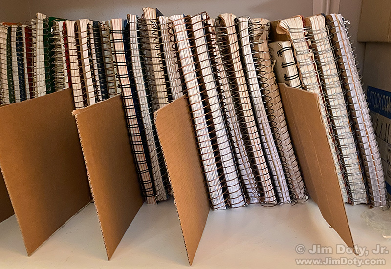
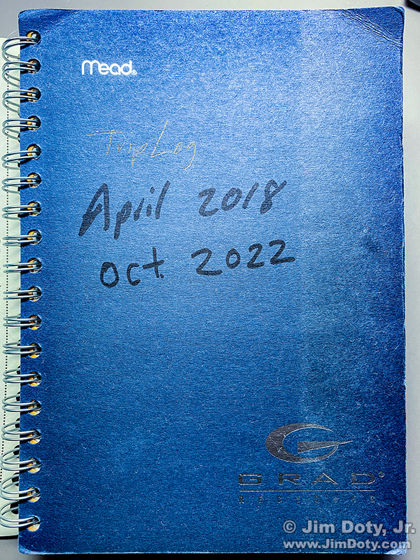
Trip Logs in chronological order.
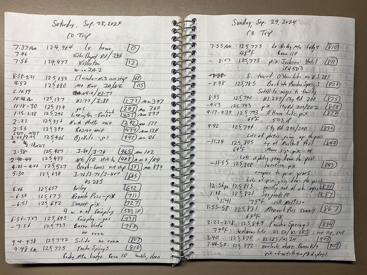
It all started when a job change meant I was doing a lot of cross country road trips. I started keeping a trip log in a spiral notebooks. Mostly I wanted a record of how I got from A to B, how far it was, and how long it took. But it also came in handy for recording photography trips. If the location was an obscure photo location I made detailed notes so I could find it again. In addition to favorite photo locations, I started adding favorite places to stay and eat to my trip logs.
Trip Log
When a spiral notebook was full, I added the ending date on the cover, I put it on a shelf next to other trip logs, and I started another spiral notebook with the beginning date on the cover.
I also learned photo editors wanted information on photo locations. This was long before cameras recorded GPS locations and smart phones that recorded GPS locations did exist. So I kept notes for myself (and just in case some photo editor wanted the info). A description for a location on Marshall Pass Colorado might look like this: “Overlook: 3 miles west of U.S. 285 on Chaffee County Road 200”.
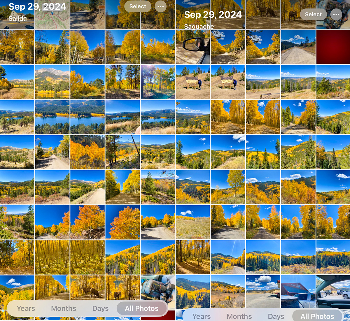
iPhone photos, Marshall Pass, Colorado, September 29, 2024.
Today I don’t do that nearly as many descriptions. I still keep trip logs, but without the detailed descriptions of all the photo locations. Photo editors today like to have GPS coordinates, not descriptions, and I’ve mostly gone the GPS route. On my last trip over Marshall Pass in Colorado (trip log at the top), there are places in my trip log that I just wrote “lots of photos”. I still write down descriptions for extra special locations.
So how do I know the photo locations? Every time I took a picture with my Canon 5D Mark III, which does not record GPS data, I would take my iPhone out of my pocket, face the same direction, and take a matching picture from the same exact location. If I submit one of these photos for publication, I will check the corresponding iPhone photo at the same place, time, and direction and grab the GPS metadata from my iPhone.
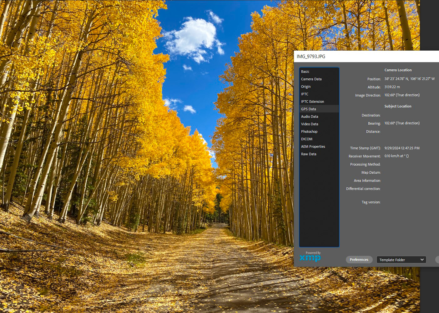
iPhone photo, Marshall Pass, Colorado, September 29, 2024. Inset: GPS coordinates.
This is a favorite spot on the west side of Marshall Pass. My trip log says this is 3 miles from the summit on the west side of the pass. I was here taking pictures until 11:55 am. (See my trip log above.) I have taken several people to this photo location, including a group of photographers on a photo safari across Colorado. On the right you can see the GPS data for this iPhone photo.
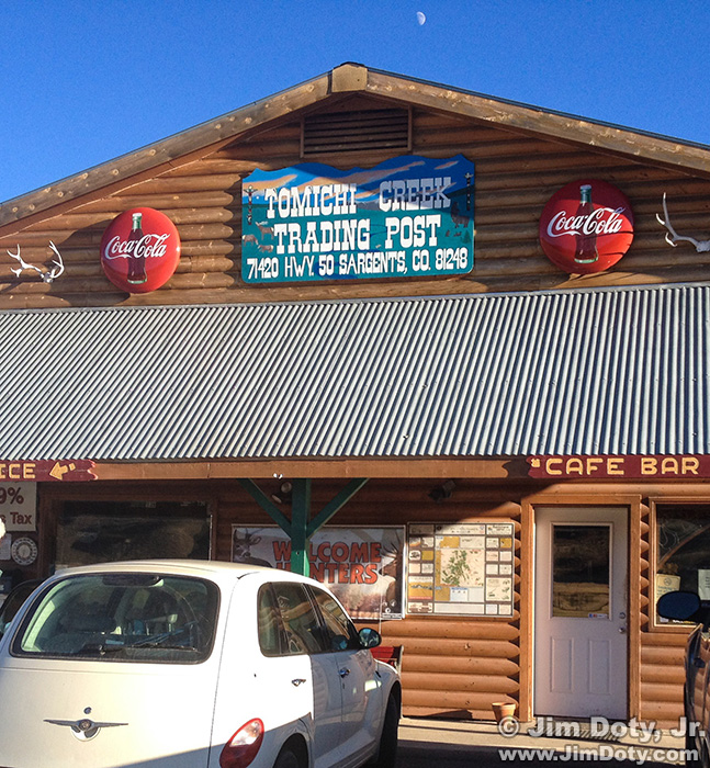
Tomichi Creek Trading Post, Sargents, Colorado
Tomichi Creek Trading Post is at the west end of Marshall Pass in tiny Sargents Colorado. It is one of my favorite places to eat on a Colorado photo trip.
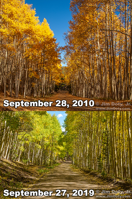
The same stretch of road on Marshall Pass, Colorado in 2010 and 2019.
The same stretch of road as the 2024 photo on two prior photo trips.