
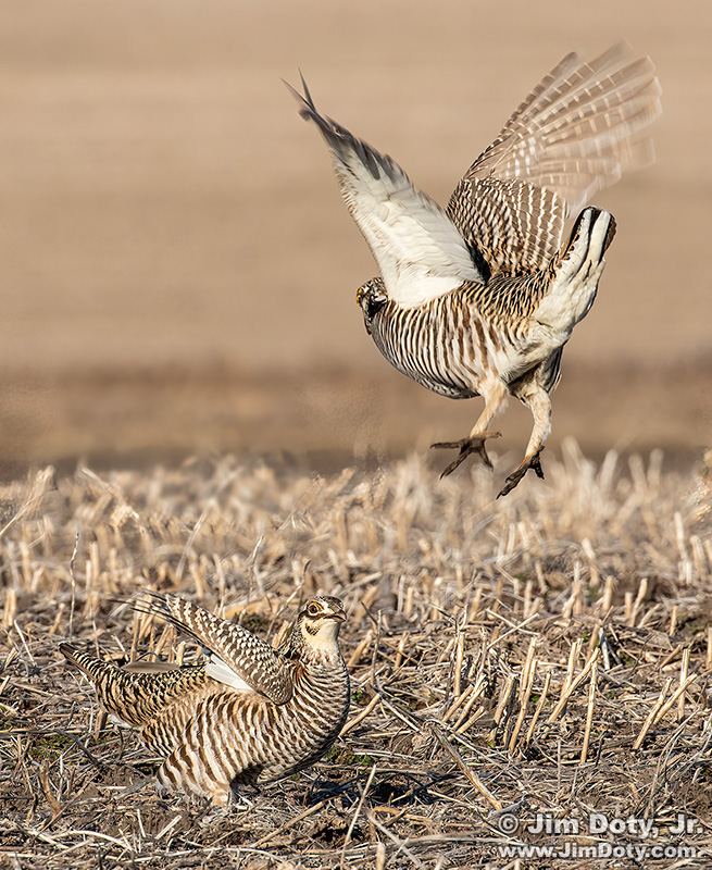
Greater Prairie Chickens fighting. February 25, 8:34 am.
Most smart phones and some digital cameras record the GPS coordinates of a photo every time the shutter button is pressed, provided you have that feature turned on. If you find a photo on the internet, you can use an EXIF Viewer to see if the GPS coordinates are embedded in the online photo. Not all cameras have this capability, and some photographers strip that information out of their photos before they post them online. I really appreciate landscape photographers that leave the GPS data in their online photos.
About Metadata
EXIF stands for Exchangeable Image File Format. It is a standardized way of storing useful information in the metadata of a photo. It usually includes the camera that was used, the date and time of the photo, camera settings (aperture, shutter speed, and ISO), and sometimes, the GPS coordinates.
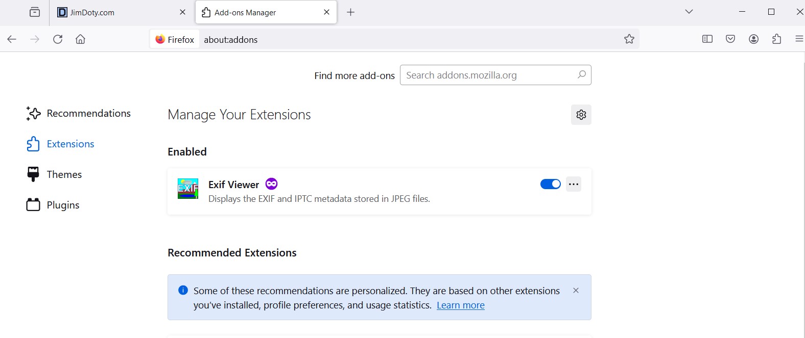
My preferred online browser is Firefox and I added EXIF Viewer by Alan Raskin as an add on extension. I’ve used it for years. (You learn how to add Exif Viewer to Firefox later on.)
How to Use Exif Viewer
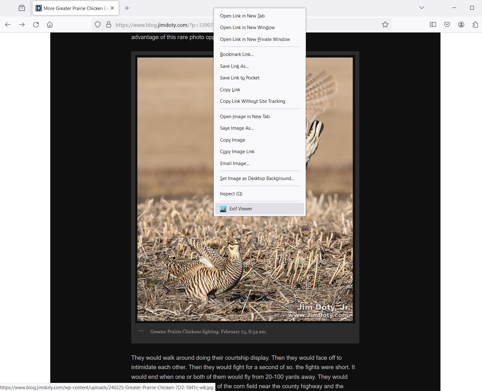
Screen Capture: Menu choices.
If you right click on photo at the top of this article (and if you have Exif Viewer as a Firefox add-on), you will see this menu. Click on Exif Viewer. (Click on any of the screen captures below to see a larger version.)
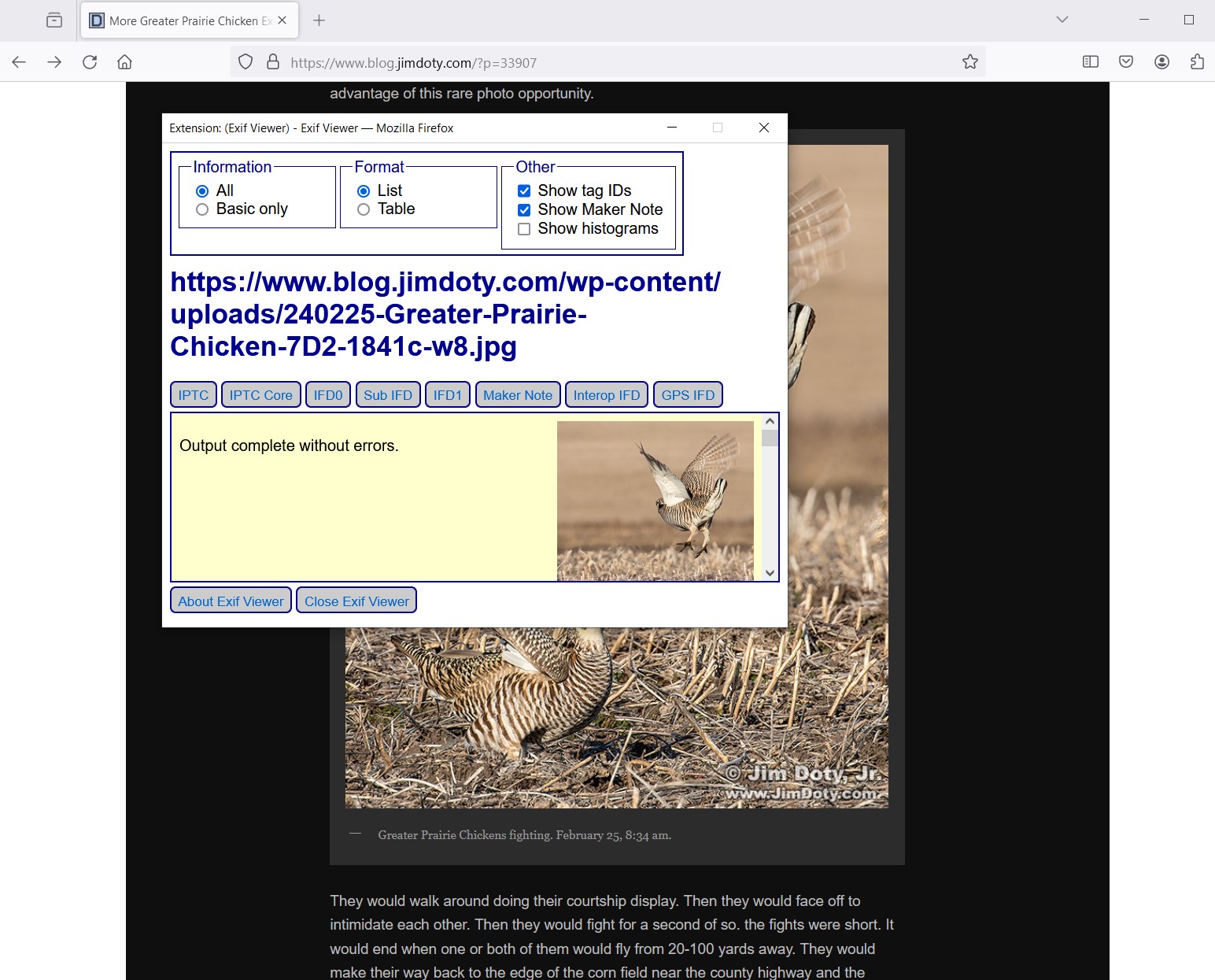
The Exif Viewer window will pop up. this what you will at the top of Exif Viewer. You see the URL for the page at my blog, the file name for the photo, and a thumbnail of the photo. Grab the menu bar at the right side of the window and scroll down until you see EXIF GPS IFD.
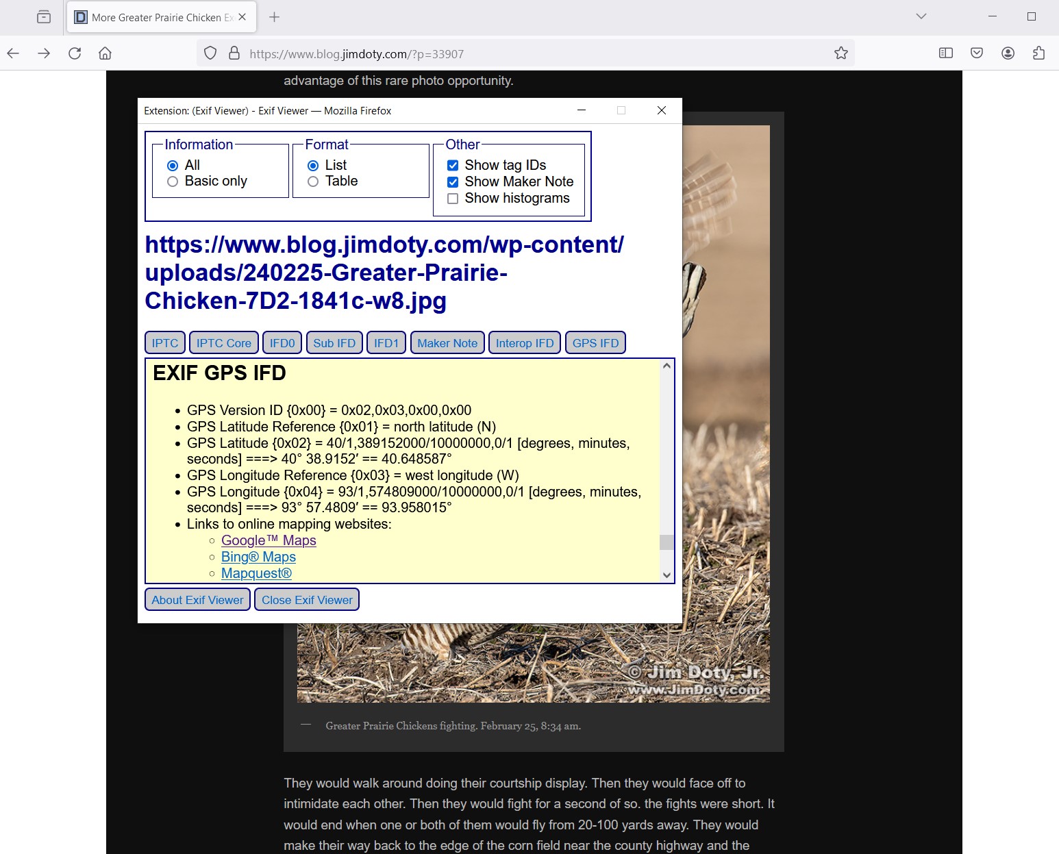
EXIF GPS Info and Map options.
It will look like this. You have the GPS coordinates for the latitude (40° 38,9152′) and longitude (93° 57.4809′) of the photo, and you have three map options. Click on Google Maps.
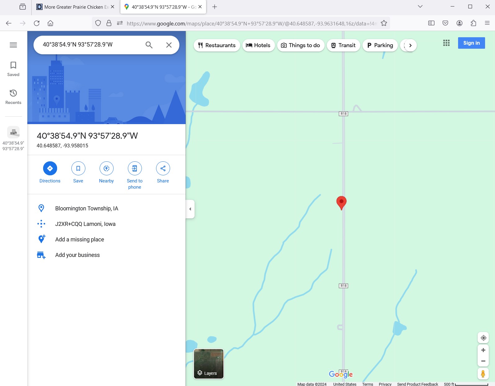
Great Prairie Chicken photo location at Google maps.
A new window will open in Firefox and this is what you will see, a standard map with the prairie chicken photo location marked with a red pin. You can zoom in or out on this map. Now click on the “Layers” icon in the bottom left corner of the map.
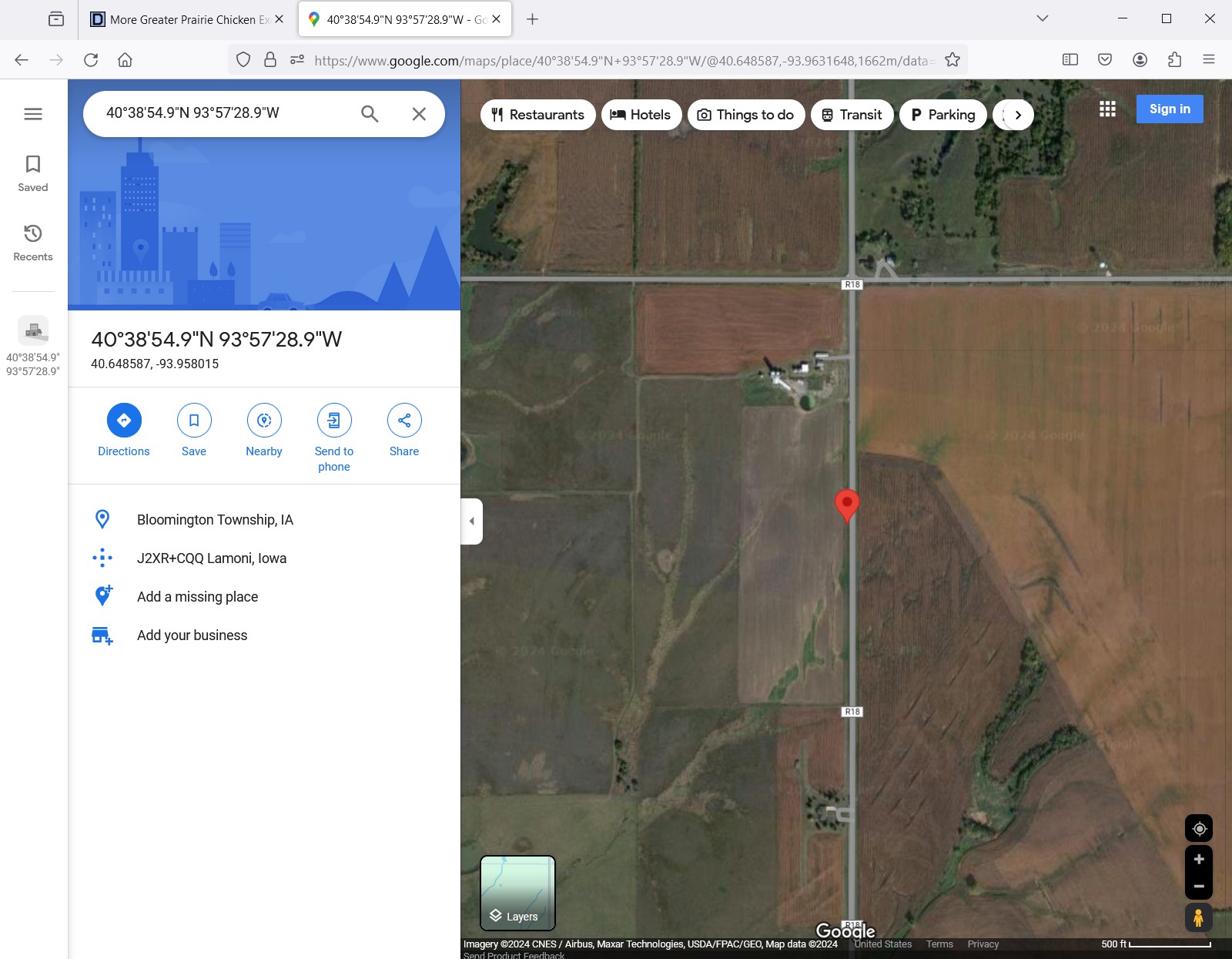
Satellite map of the location of the Greater Prairie Chicken photo.
You get a satellite map. You can zoom in or out on this satellite map. If you zoom out you can see nearby towns and Interstate-35. Click the layers icon again if you want to go back to the standard map.
It is as simple as that!
How to Add Exif Viewer to Firefox
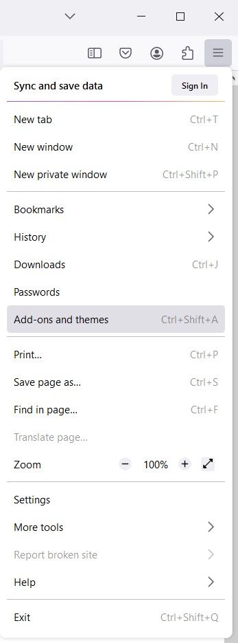
Firefox Menu
While you are online, click on the three menu bars at the upper right corner of Firefox. Choose “Add-on and themes”.
Firefox Add-ons search.
In the search box (“Find more add-ons”) type in Exif Viewer. When you find it, add it to Firefox.
This article was posted February 26, 2024 and updated February 29, 2024.
Links
More Greater Prairie Chicken Excitement!
Greater Prairie Chicken Excitement!
“How To” Series: Using GPS in Photography