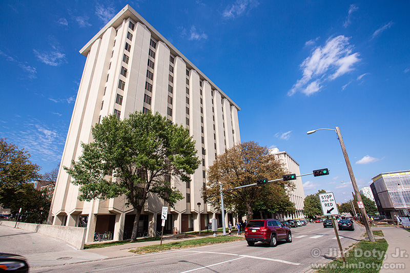
I had heard rumors that the twin campus towers, Willa Cather and Ezra Pound Halls, were going to be demolished. Cather Hall was my home for three years at the University of Nebraska in Lincoln and I wanted a current picture. On my way to a photo workshop in Colorado I stopped in Lincoln to create some images. The view above is looking north on 17 Street with Pound Hall in the foreground, and Cather Hall in the background.
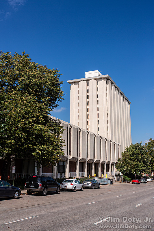
I drove a little farther north on 17th St and took a picture of Cather Hall and the adjoining cafeteria.
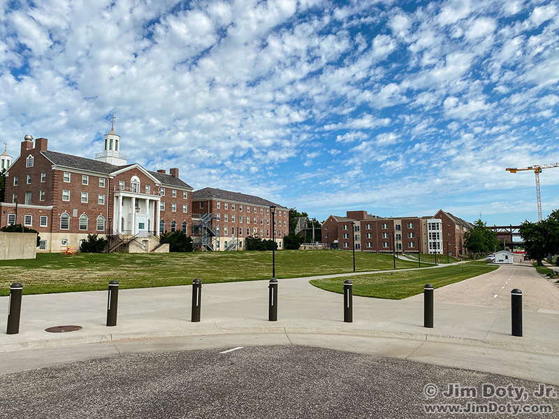
I was back in Lincoln recently and Cather, Pound, and the cafeteria are all gone. This photo was taken not far from of the location of the 2016 Cather Hall/cafeteria photo just above this one.
In 2016 and 2022 I took photos from the exact same locations with a Canon DSLR (which does not have GPS built in) and my iPhone so I would have GPS data. This was a good opportunity to do a GPS accuracy comparison. I had tall buildings in 2016 and much shorter buildings in 2022.
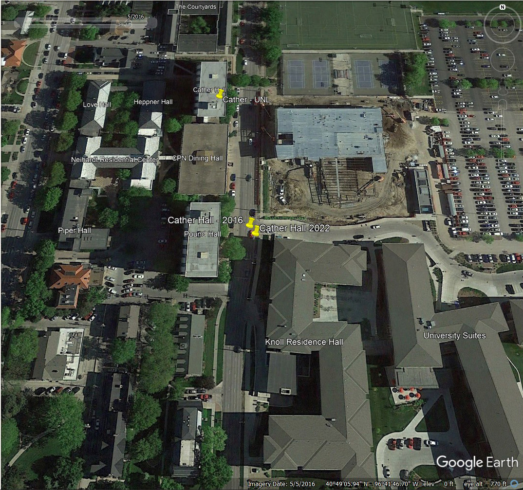
Using coordinates from my iPhone, I dropped yellow pins on this 2016 satellite image of 17th Street. The two yellow pins in the middle show the locations of the 2016 and 2022 Cather Hall photos, (even though Cather Hall is gone in 2022). Despite being close to two tall buildings in 2016, the yellow pins are pretty close to each other and to the location where I was standing when I took the photos. Most consumer grade GPS coordinates from cameras are within 15-30 feet of the actual location, and sometimes much closer.

This is the iPhone image from the exact same location as the photo at the top of this article. The image at the top was taken with a 17mm wide angle lens. The iPhone lens for this photo is equivalent to 29mm on a 35mm camera. Not nearly as wide. But everything lines up the same in both photos. As you can see from the image at the top, I was standing on the edge of the sidewalk, not too far south of the pedestrian crosswalk lights, and opposite the drive across the street on the south side of Pound Hall. This is the photo where the iPhone GPS data got into trouble.
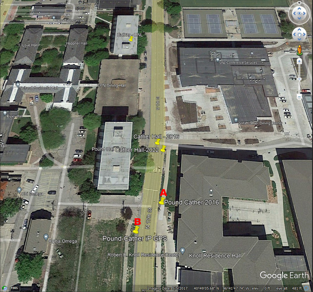
I manually dropped the yellow pin marked with a red A at the place I was actually standing when I took the 2016 photo. I was on the edge of the sidewalk, opposite the drive across the street on the south side of Pound Hall, and not far from the street lights at the pedestrian sidewalk. You can see the shadows of the lights in this satellite image.
Next I dropped the GPS coordinates from the iPhone photo in to Google Earth Pro. That gave me the yellow pin that I marked with a red B. This is across the street and well south of my actual shooting location.
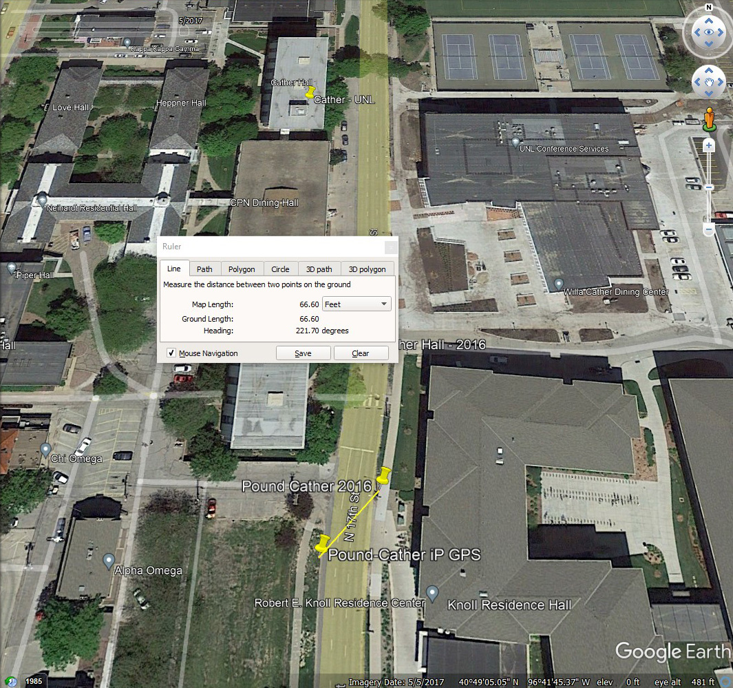
Google Earth Pro has a ruler tool for measuring distances. The distance between yellow pins A and B is 66 feet, give or take a little. That is much worse than usual for the typical camera’s GPS data. Why? The urban canyon effect.
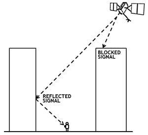
Tall buildings, trees, and other tall objects can mess with the camera’s angle of reception from GPS satellites. In 2016 had a very tall building on one side of me and another building behind me. That would account for the difference. In several years of checking GPS data from cameras, the photo of Pound and Cather Halls is the biggest difference I have found between my actual shooting location and the GPS location data from the camera. The urban canyon effect is for real.
In 2016 the GPS data was accurate for the photo across the street from Cather Hall, but not accurate for the photo taken across the street from Pound Hall a half block south down the street. Why? It all depends on exactly where the satellites are in the sky. Just like you can walk from sunlight into the shade, you can walk out of the view of a satellite that is important to pinpointing where you are. Plus the GPS satellites are moving all the time as they orbit the earth. A satellite that can see you now might not be able to see you later, even if you don’t move.
The important thing to remember is GPS accuracy can go down if you are around tall buildings, close to big trees, or near other tall objects. That includes being down in a canyon with a limited view of the sky.
Link