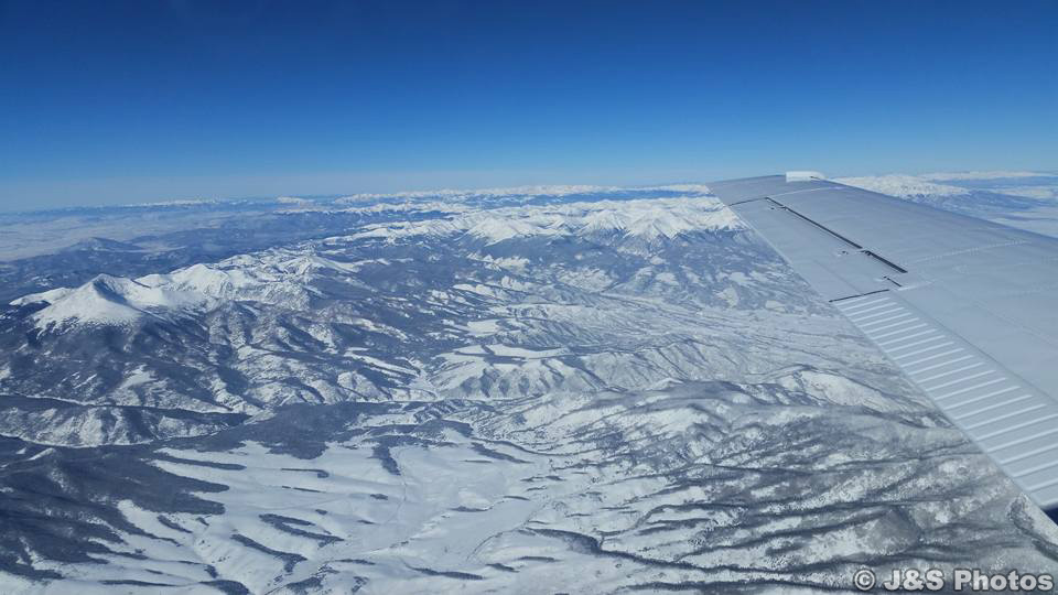
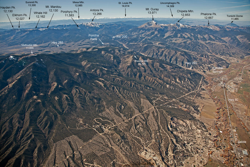
Recently, two of my friends were flying from southern Colorado to Denver. They snapped this cell phone photo from their airplane and posted it online. I was quite taken with this photo for several reasons. My friends are two remarkable people, I love the Colorado Rockies, and Mt. Ouray (on the left) is special in my life.
I would talk about why my friends are such special people, but that would embarrass them, so I will move on to the Colorado Rockies.
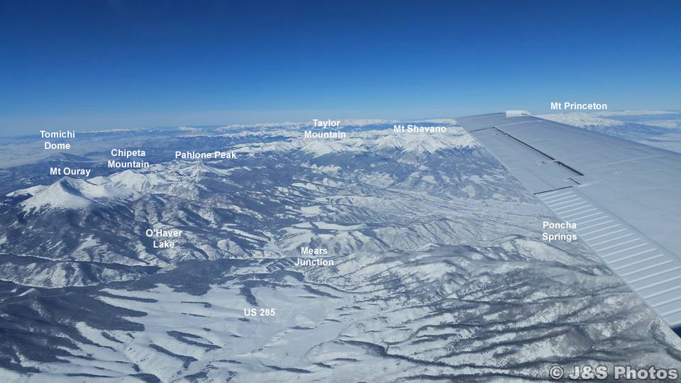
I got the idea that I should label the mountains in this photo and send it back to my friends so they would know what is in the photo, but first I had to be sure it really was “my” mountain. Ouray isn’t the only peak in Colorado with a large, bowl-shaped glacial cirque, so I needed to be sure.
The cirque on Mt Ouray is called “The Devil’s Armchair” and faces east. That means, if this is Mt. Ouray, this photo was taken looking northwest. U.S. 285 is just barely visible angling off the lower left edge of the photo. So I went to Google Earth, picked Villa Grove, Colorado as the location (Villa Grove on U.S. 285 is southeast of Mt. Ouray) and let Google Earth do its thing.
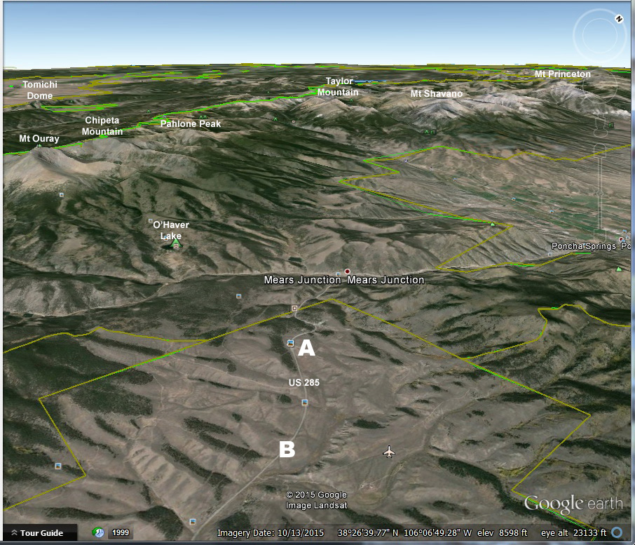
Google Earth image, looking northwest from the area east of Villa Grove, Colorado. Click to see a larger version.
Once Google Earth found Villa Grove, I moved the location to east of VillaGrove, putting U.S. 285 to the west. I tilted the view so I was looking toward the horizon instead of straight down, and then changed the direction of view from north to northwest. There was Mt. Ouray, U.S. 285, and the Sawatch Range with close to the same view as my friends’ photo from the plane. I had my confirmation. The Google Earth Landsat image had Mears Junction and Poncha Springs already labeled, so I added the names of several of the mountains, plus O’Haver Lake, and U.S. 285.
My next step was to label my friends’ photo with the same mountains, O’Haver Lake, and U.S. 285 heading south from Mears Junction. If you click on the photo you will see a larger version and you can just barely make out U.S. 285 as it curves near a grove of trees, and curves the other way past several more groves of trees. These distinctive curves and groves are quite clear in the Google Earth image.
I found an aerial photo of the same curves and groves from farther north and looking back to the southwest. The curve just above the “US 285” label in the above photo (labeled “A” on the Google Earth image above) is labeled “A” in the photo immediately below. The curve that goes around several groves of trees that is below the US 285 label in the image above (and labeled “B” on the Google Earth image above that) is labeled “B” in the photo below.
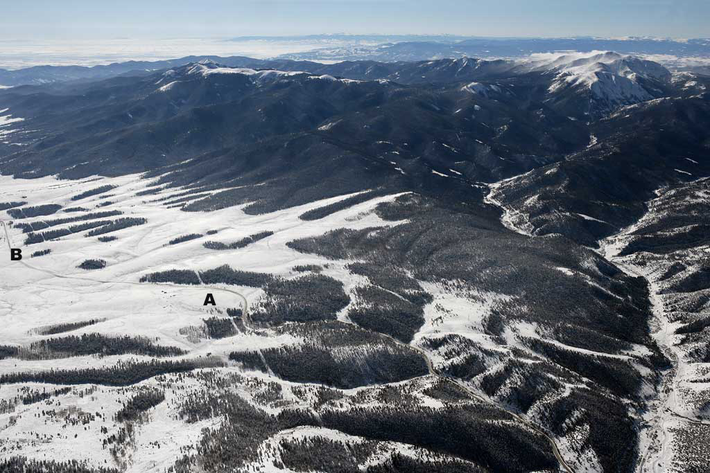
U.S. 285 going south. You are looking southwest from a location somewhere east of Mears Junction. Click to see a larger version.
The valley on the right side of the photo has part of the county road that goes to O’Haver Lake and over Marshall Pass.
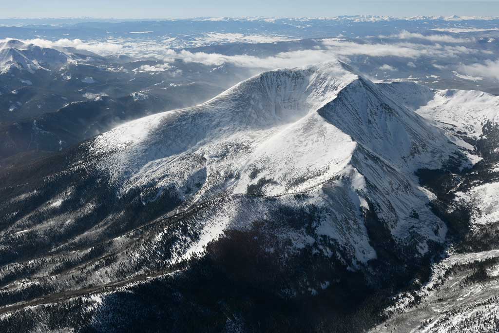
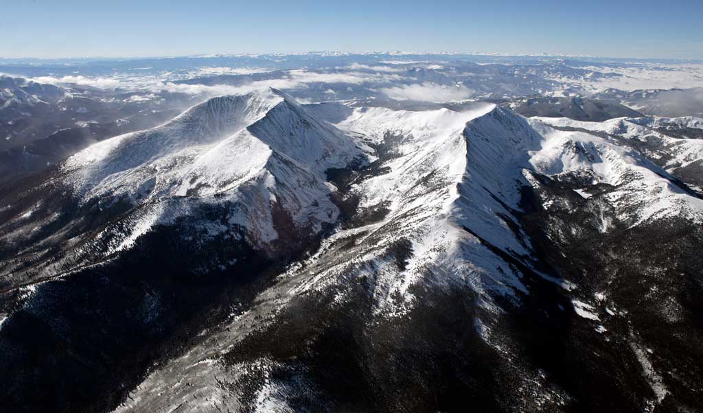
I found a nice photo of the distinctive shape of The Devil’s Armchair.
And I also found a nice aerial photo of Mt. Ouray with Chipeta Mountain.
And lastly, an aerial photo of the whole area, looking back in the direction of my friends’ flight path to the southwest.
So why, you might ask, do I have this attachment to Mt. Ouray (and O’Haver Lake)? That will be in Part Two.
Originally posted Dec. 20 2015. Revised Jan. 30, 2017.
Link

