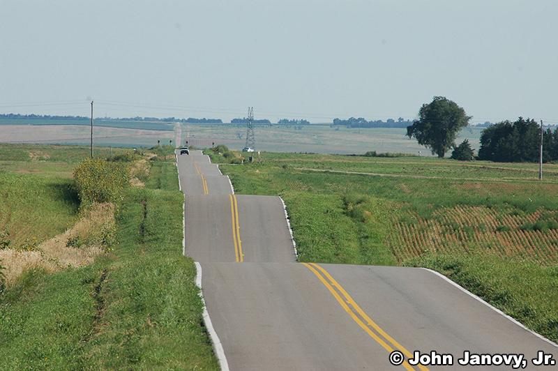
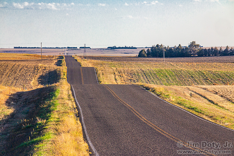
The infamous Road to Roscoe. Photo by Dr. John Janovy, Jr. 2015.
It all started October 8, 2022 when John Janovy re-posted a photo of the infamous Road to Roscoe that he had taken in 2015. I was intrigued by the washboard nature of the road. Not only that, in just 4 days on a trip from Iowa to Colorado, I would be just a few miles from where John took this photo. I met Dr. Janovy when I was a student at the University of Nebraska and he was a parasitologist in the biology department. We both share an interest in photography and the natural world, we occasionally send messages to each other, and we are friends on Facebook.
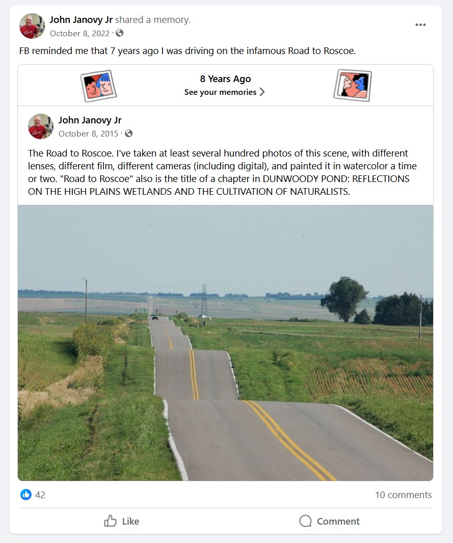
John Janovy’s October 8, 2022 Facebook post.
In his original October 8, 2015 post, he posted the above photo and he wrote, “The Road to Roscoe. I’ve taken at least several hundred photos of this scene, with different lenses, different film, different cameras (including digital), and painted it in watercolor a time or two. “Road to Roscoe” also is the title of a chapter in DUNWOODY POND: REFLECTIONS ON THE HIGH PLAINS WETLANDS AND THE CULTIVATION OF NATURALISTS.”
His interest in this photo location got my attention. There are all kinds of photographers who like to plant their tripods where other photographers have taken famous pictures, like hundreds of photographers who have recreated Ansel Adams’ classic image of the Grand Tetons and Snake River. I like to go to famous (and not so famous) locations where other photographers have taken images that get my attention. I wanted to create an image that was as close as I could get to John’s “Road to Roscoe” image. Using Google Earth Pro I found the road and the high tension power lines, but it was hard to pin down the exact location of John’s photo, so I sent him a message and asked if he would share the exact location with me. He sent me the GPS coordinates.
On October 12, my wife and I were on our way from Iowa to Colorado. We got off I-80 at the Roscoe exit and I drove north on the Road to Roscoe. My wife had a GPS and she was calling out the latitude numbers for me as I kept my eyes on the road. I slowed down as we got closer.
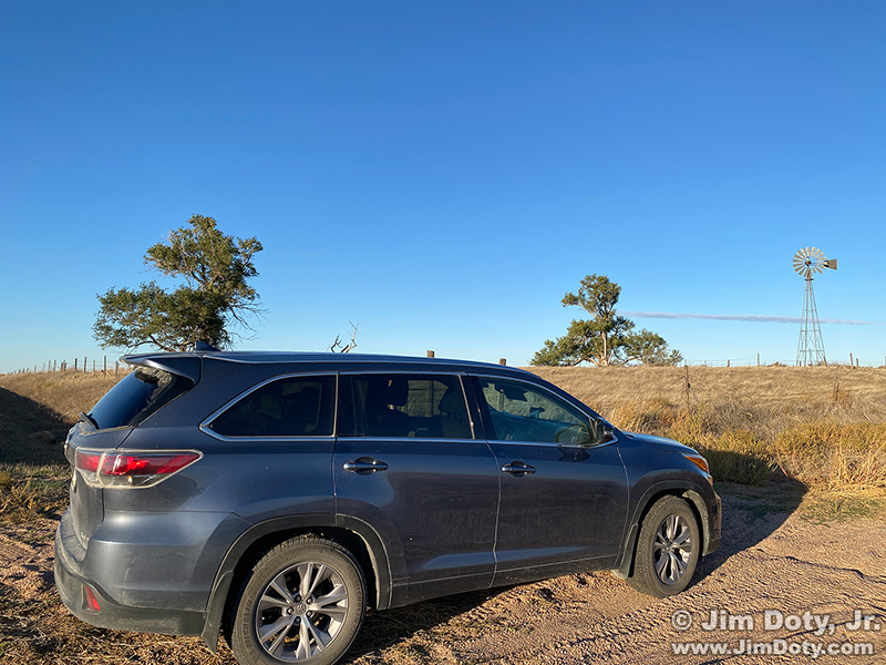
Our car on the dirt turn out.
When she called out John’s GPS latitude, there was a dirt turnout to the right on the east side of the road. It was the only safe place to pull off the road and take a picture. I could see immediately why John picked that spot to take so many pictures of the washboard road
“Road to Roscoe”, Nebraska, Jim Doty, Jr. October 12, 2022.
I got out of the car, set up my tripod, and did my best to frame the photo like John framed his 2015 image. (I tried other compositions too.) I had his photo on my iPhone to compare with what I saw in the camera’s viewfinder. I was pleased with the final result.
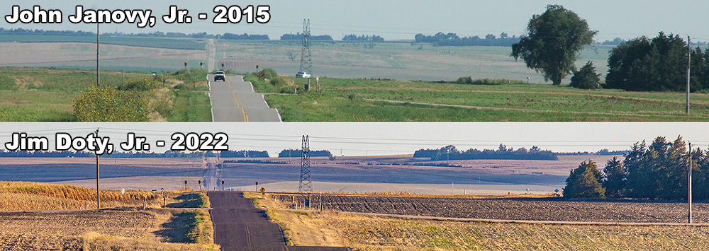
The infamous Road to Roscoe by John Janovy and Jim Doty. Click the image for a larger version.
As you can see from this cropped comparison of both photos, everything is the same except for the season, a car on the road, and one deciduous tree that has come down in the intervening years.
When we came back from Colorado, we stopped again but the light wasn’t as nice. I hope to go back again some day and capture the scene at a different season or in different light.
If you are on I-80 west of North Platte and you want to take pictures at this location, here are the directions.
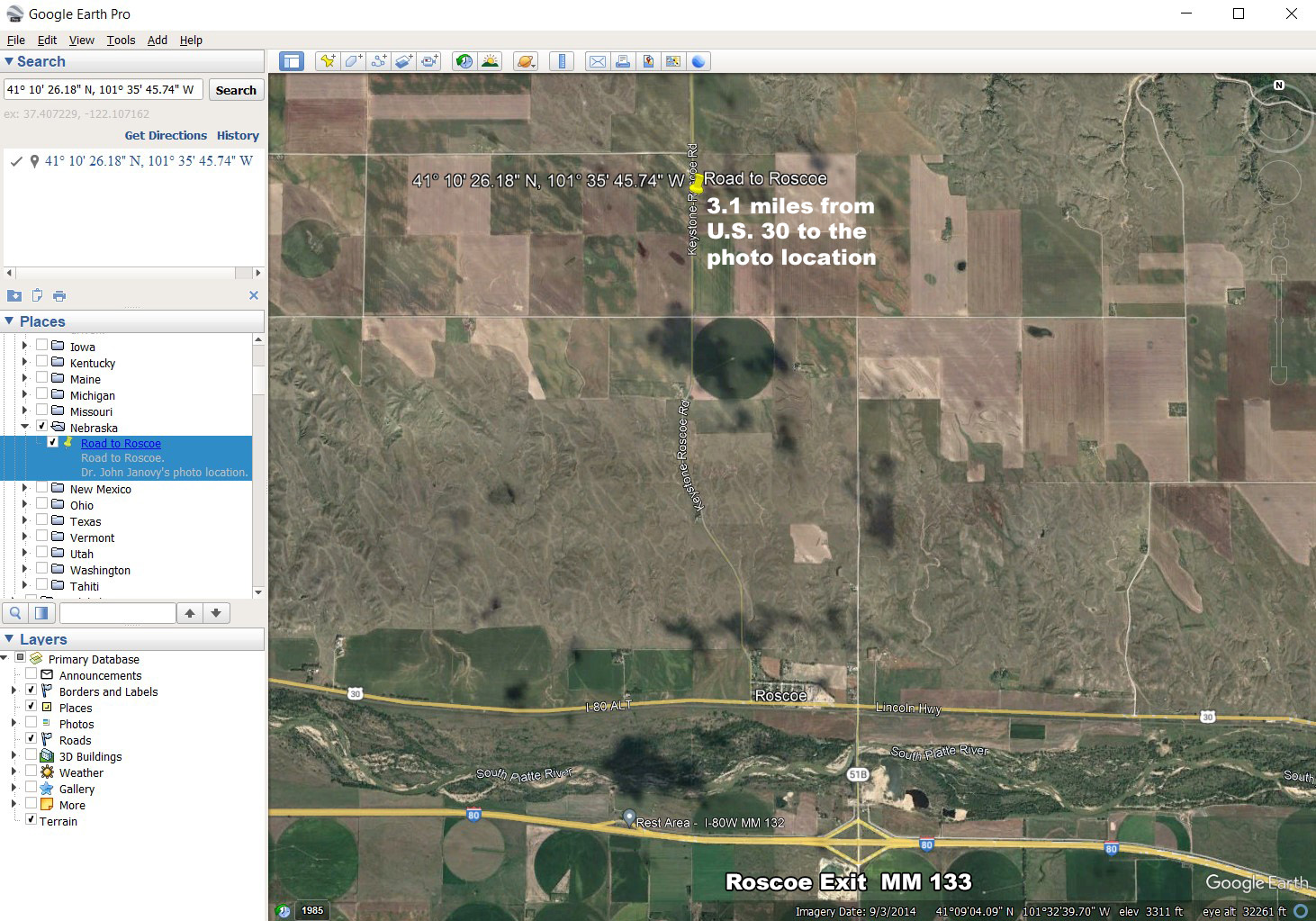
Google Earth satellite image of I-80, Roscoe Nebraska, and the photo location (yellow pin). Click the image to see a much larger version.
Take the Roscoe exit, MM 133, and drive north across the bridge over the North Platte River. Turn left (west) on U.S. 30 and drive through the tiny village of Roscoe. On the west side of town, turn right (north) on the Keystone-Roscoe Road (i.e. the “Road to Roscoe”). Check your odometer. It is 3.1 miles from U.S. 30 to the photo location which is a gravel turn out on the right side of the road. It is the only safe place to get your vehicle off the highway and take a picture. It is a total of 4.4 miles from the interstate exit to the photo location, so it is just a short jaunt out of your way.
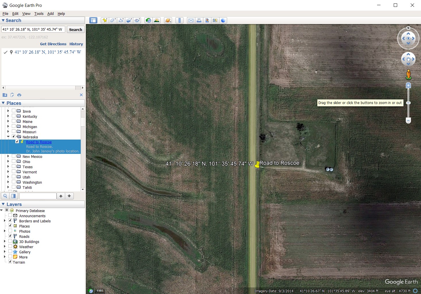
Satellite image of the Road to Roscoe photo location. Click the image to see a larger version.
In this satellite image you can see the dirt turn out on the east side of the road.
If you like the natural world and books like Annie Dillard’s classic Pilgrim at Tinker Creek, I highly recommend John Janvoy’s Dunwoody Pond. As I write this article it is sitting on the bookshelf behind me.