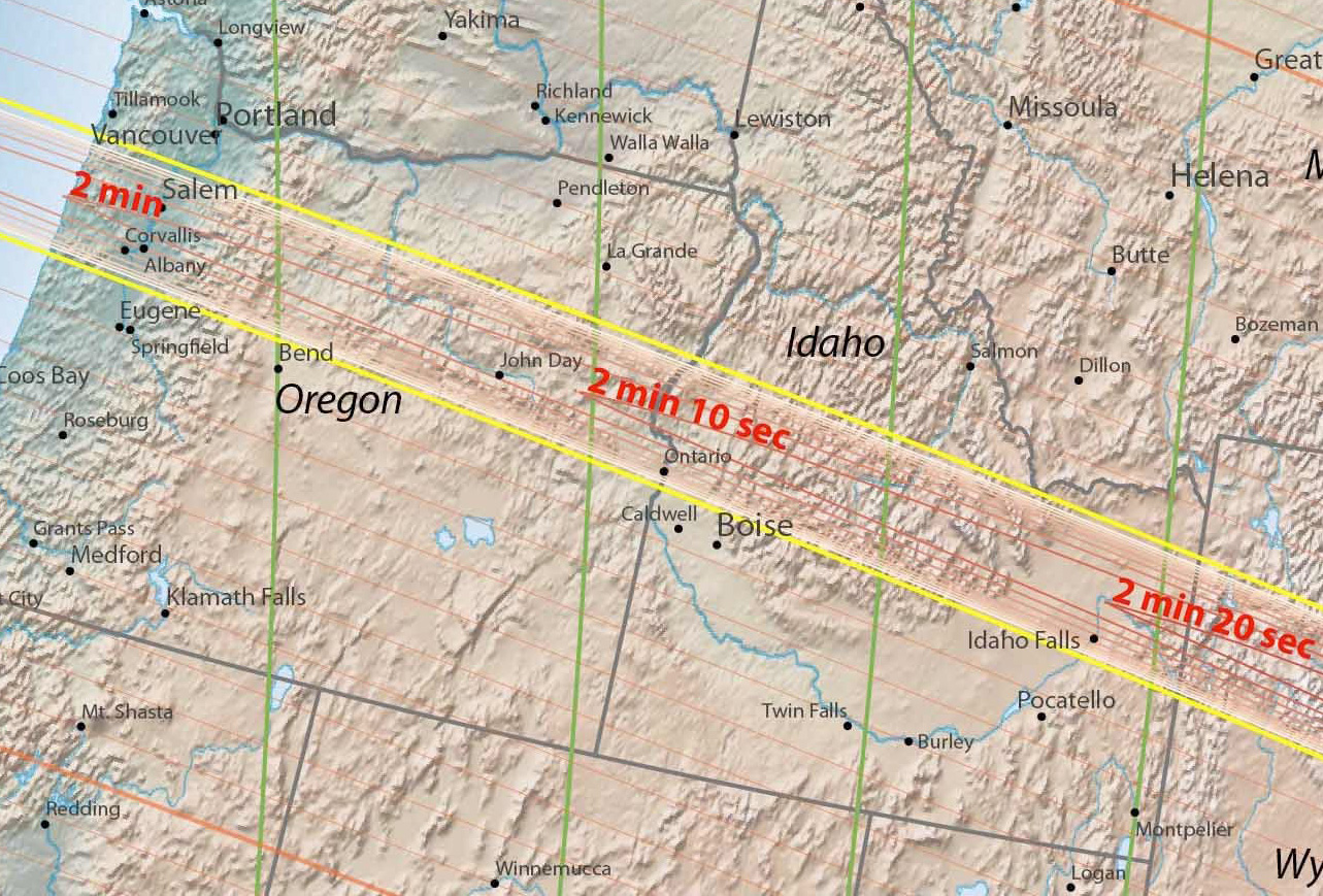
Oregon and Idaho. Click for a larger version.
This series of four maps show the path of the totality across the United States for the “Great American Eclipse”, August 21, 2017. The goal for the longest view of the total eclipse is to get as close as possible to the center of the totality path. If you are outside the path of totality you will not see a total eclipse. For more information, read How to Find, View, and Photograph the “Great American Eclipse” – August 21, 2017, my comprehensiveness guide to the eclipse information.
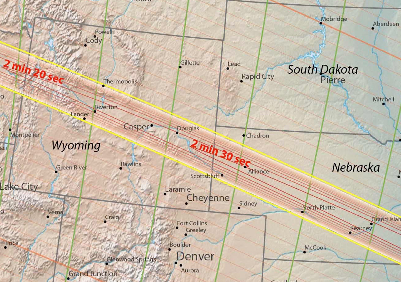
Wyoming and Western Nebraska. Click for a larger version.
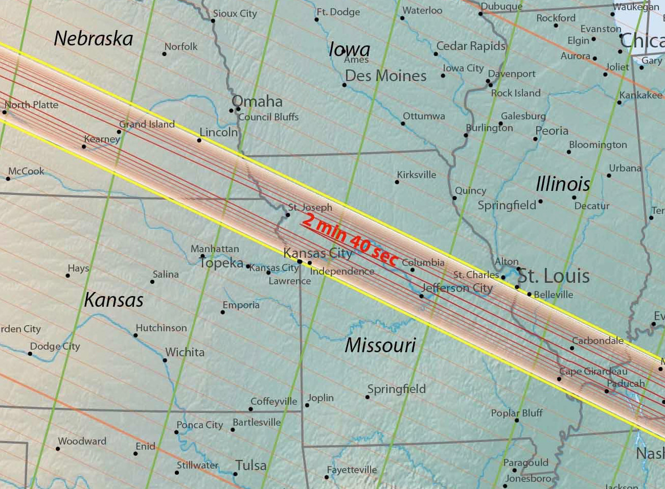
Eastern Nebraska, Kansas, Missouri, and Illinois. Click for a larger version.
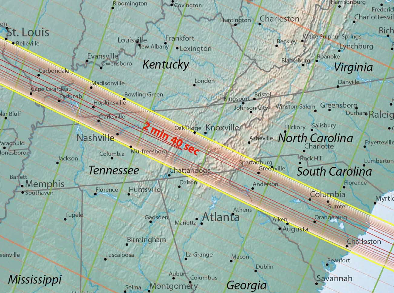
Kentucky, Tennessee, Georgia, and South Carolina. Click for a larger version.
The Great American Eclipse Series
The Great American Eclipse Series  – All of my eclipse articles are listed at this link. Check back for new articles as they appear.
More Links
How to Find, View, and Photograph the “Great American Eclipse†– August 21, 2017 – My comprehensive guide to the best information on the Great American Eclipse, August 21, 2017.
Great American Eclipse Fly Over Video
Eclipse glasses, goggles and binoculars at my Amazon powered photography store