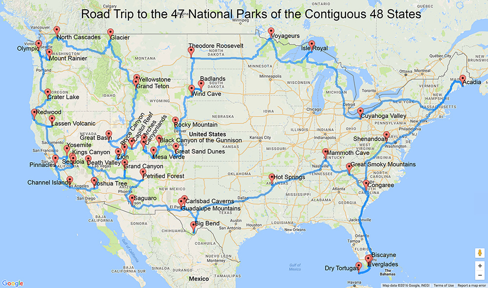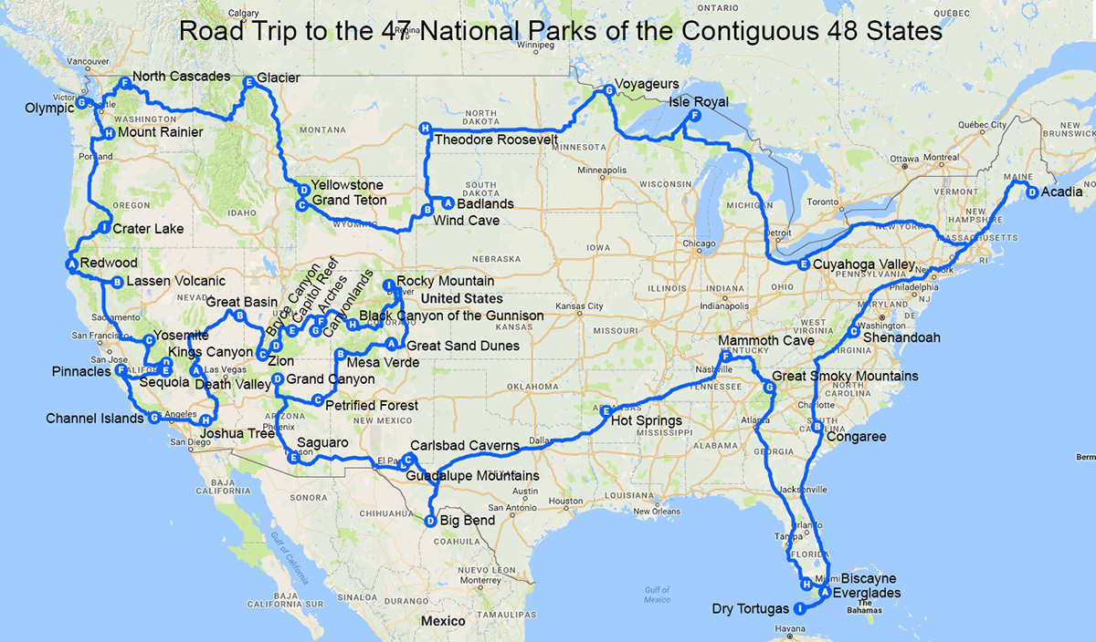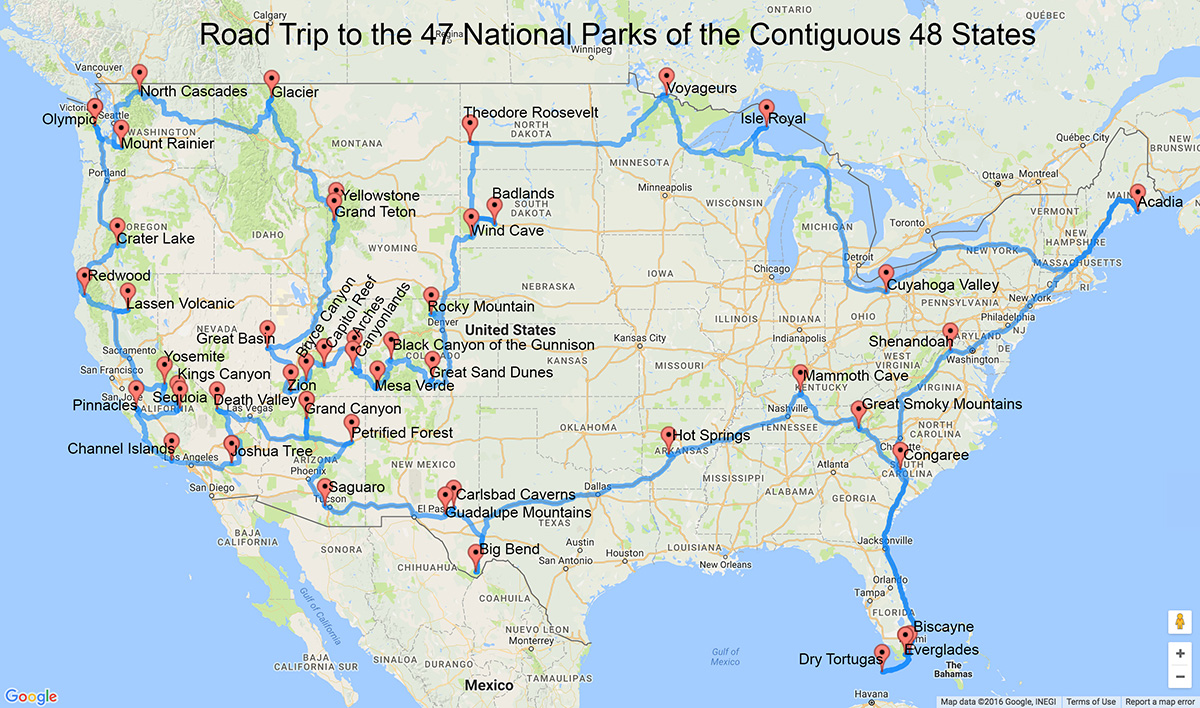
Travel Route to 47 U.S. National Parks by Randy Olson. A larger version of this map is farther down the page.
So you wake up one morning with the crazy notion you might want to go on a road to all 47 of the U.S. national parks in the contiguous 48 states. Setting aside the sanity of such a project, how would you go about it? And what if you only want to go to some of these parks?
Inspired by the 100th birthday of the National Park Service (August 25, 2016), I was asking myself the same questions. It took a little bit of work on Google and I found two people who designed just such a road trip, Randy Olson and Travis Tamez. The routes around the U.S. are essentially the same with the exception of how to handle the cluster of national parks in the Southwest (Colorado, Utah, Arizona, and New Mexico).
The route drawn up by Travis Tamez is at Isle Box. For the Eastern U.S. the routes by Travis and Randy are the same from Big Bend east, north, and back west to Wind Cave. The differences in both routes are from Wind Cave around the western U.S. and back to Big Bend in Texas. From Wind Cave in South Dakota, Travis takes you straight across to Wyoming, up to Glacier and the Pacific Northwest, down the west side of the country, and then on a big loop to all the parks in the Southwest before dropping down to Big Bend.
The route drawn up by Randy Olson is at his own site. From Wind Cave, Randy’s route drops down to do half the parks in the Southwest (Colorado and Utah), then back up to Wyoming, Glacier, and the Pacific Northwest, down the west side of the U.S., then the rest of the parks in the Southwest (Arizona and New Mexico) before dropping down to Big Bend in Texas. At first glance it may look like this route goes more out of the way but it is shorter by 1260 miles. Randy’s route is 14,498 miles. Travis’ route is 15,758Â miles.
Both sites have interactive maps that break down the sections of the route. And you will have to go on some ferry trips to get to some of the parks (like Isle Royal in Lake Superior). I don’t have a preference for one route or the other. I added the names of the national parks to both maps above although it gets a bit cluttered in the Southwest to do that.
If you average 500 miles per day it will take you a month to do either route but that is just crazy and allows precious little time for sight seeing and photography. So figure a hard month of driving just to drive the route. Then you need to add at least another month or two to spend time seeing and photographing the parks. If you have the time to do a two or three month and this is your thing, go for it. For the rest of us a trip that long just wont work. It makes more sense to do sections of a route for a week or two at a time. That means you might end up making up your own route, depending on where you live. I did that for Southern Utah.
I had four days to drive from Denver to the San Francisco Bay Area. That is only a two day drive by the most direct route and I’ve never been to Southern Utah, so I decided to use the two extra days to see Arches, Dead Horse Point (a state park), Canyonlands, Capitol Reef, Grand Staircase-Escalante, Bryce Canyon, and Zion. I photographed all seven parks in a little over 46 hours. I had a great time but 46 hours wasn’t nearly enough time. A week would have been much better.
Another way to find the shortest route between several places is to use RouteXL (link below).
So pick one or more parks, plan, allow enough time, and go have fun.
Happy Shooting!
Posted August 26, 2016. Revised February 12, 2018.
My Favorite Photo Location Guides
To see the best sites and get the best photographs it helps to know where and when to show up. That is where location guides come in. They will not only tell you the best spots in each national park (or other location), they will tell you the best season (or seasons) to be there, and the best time of day.
Tim Fitzharris wrote National Park Photography which is the best photography and location guide to the 20 best national parks. QT Luong wrote Treasured Lands which is the best location guide to all 59 national parks. More about these books here.
Some of the very best area location guides are published by Laurent Martres. There are six books in the series (in the middle in the photo above) and Martres is the author of three of them. Greg Vaughn and Gary Crabbe wrote the others. In the back of each book all the locations in the book are rated from 1 to 5 for “Scenic Value” and “Photographic Interest” (they aren’t the same). They also rate the difficulty of the drive to each location (from easy paved roads to difficult 4 wheel drive only excursions) and the difficulty of walking to the location from where you park your vehicle (from a short level stroll to a long uphill and/or downhill hike). I wish all guide books were as good as the books in this series. You can learn more about my favorite scenic location guides in this article.
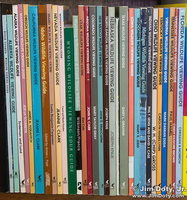
If you also happen to be into wildlife photography the Watchable Wildlife Series (photo immediately above) tells you the best locations to see and photograph wildlife on a state by state (U.S.) and province by province (Canada) basis. Some of the best wildlife locations are also very good for landscape photography.
There are a lot of other excellent locations guides out there. I have three bookshelves filled with scenic and wildlife location guides. The other books I recommend are at these two links.
The Best Scenic Photo Location Guides
How To Find Wildlife, The Best Books
All of these location guides are in the photography books section of my photography store which is powered by Amazon.com. You get the same great Amazon prices, service, and guarantee, and you help support my photography sites. Thanks for your support!
Links
U.S. National Parks Travel Route by Travis Tamez
U.S. National Parks Travel Route by Randy Olson
RouteXL.com – Enter up to 20 addresses (for national parks enter each park’s address) and RouteXL was design the shortest route to all 20 addresses.
A List of all 59 U.S. National Parks
National Park Service – the official web site
Find Your Park – find a national park to visit


